
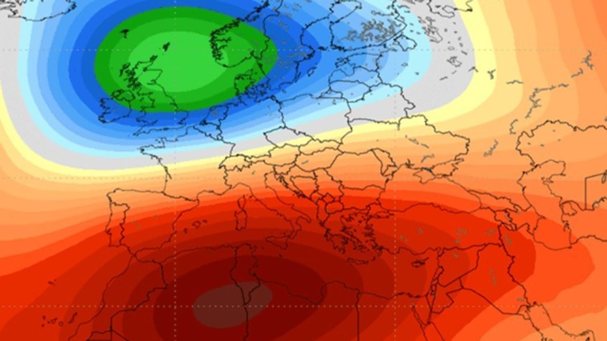
While the Super El Niño phenomenon is rapidly strengthening in the Pacific Ocean, another important oceanic phenomenon has emerged in tropical areas.
It is about the positive Indian Ocean Dipole (IOD), a phenomenon that causes large differences in sea surface temperatures between the eastern and western parts of the Indian Ocean.
According to seasonal forecasts, the combined influence of the positive Indian Ocean Dipole and Super El Niños may continue throughout the fall and early winter, affecting atmospheric patterns and climate conditions in several regions of the world.
This combination could affect the movement of air currents over the northern hemisphere and affect weather conditions during the winter of 2026/2027, writes Severe Weather Europe.
What is the Indian Ocean Dipole?
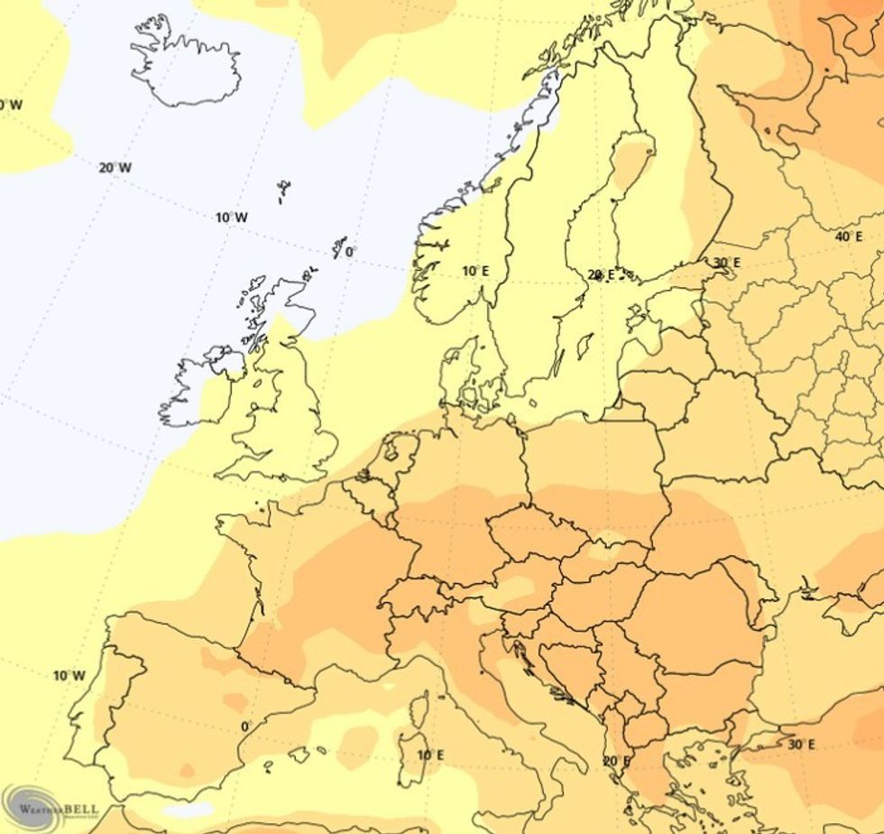
The Indian Ocean Dipole (IOD) is a climate phenomenon that occurs when sea surface temperatures in the eastern and western parts of the Indian Ocean begin to differ significantly. It is because of this contrast between the two areas of different temperatures that the phenomenon is called a “dipole.”
During the positive phase of the IOD, the western Indian Ocean warms more, while the eastern part cools. Air rises over the warmer waters, while air sinks over the colder areas, affecting wind direction, precipitation distribution, and the movement of large atmospheric systems.
For this reason, the IOD is not considered a purely regional phenomenon. Changes that occur over the Indian Ocean can be linked to broader atmospheric processes in the Pacific Ocean and subsequently affect weather patterns in distant parts of the globe.
According to the latest data, the positive phase of the IOD has just begun to develop, appearing at the same time as the Super El Niño is strengthening, which could create an important combination for climate developments over the coming months.
The eastern part of the observed area is cooling, while the western part is warming, causing the temperature difference between these two regions to increase even more during the fall.
Forecasts indicate that this is not expected to be a short-term phenomenon. The positive phase of the IOD could continue throughout the fall and weaken only at the beginning of winter, affecting atmospheric patterns and the distribution of precipitation in different regions of the world.
Super El Niño is rapidly strengthening
At the same time, a powerful Super El Niño is developing in the Pacific Ocean, which is appearing with unusual intensity.
The latest analyses show that sea surface temperatures in the central and eastern parts of the Pacific Ocean are 4 to 5 degrees Celsius higher than the usual average for this period.
But the greatest amount of heat is stored beneath the ocean’s surface. At depths of up to 500 meters, a zone has been discovered with temperatures reaching more than 8 degrees Celsius above average, indicating extraordinary reserves of thermal energy that could influence climate developments in the coming months.
This large mass of warm water is gradually moving towards the eastern part of the tropical Pacific, where it is rising towards the surface and further strengthening the El Niño phenomenon.
Seasonal climate models predict that this episode could easily exceed the threshold used to define a Super El Niño. If these predictions are confirmed, this phenomenon could rank among the strongest El Niño events ever recorded, with the potential to influence global weather patterns over the coming months.
How do two oceans together affect the weather?
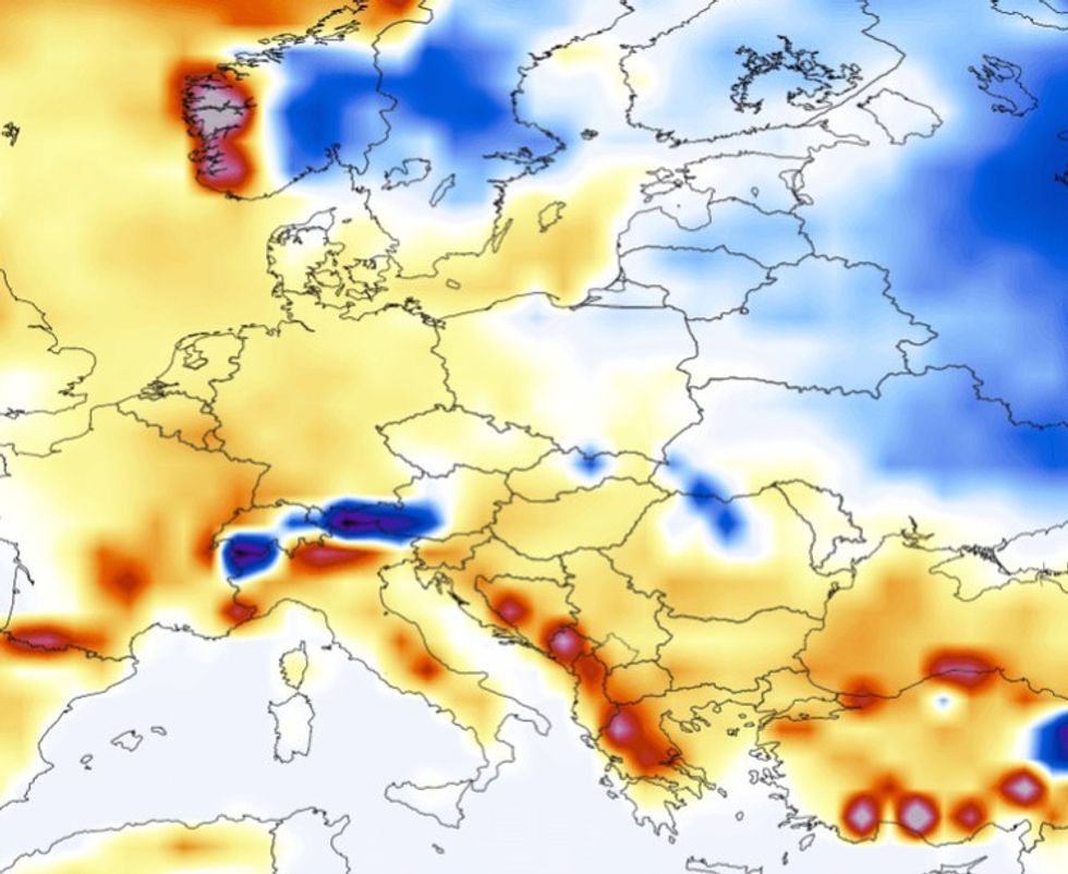
Large changes in sea temperatures directly affect the distribution of heat and energy in the atmosphere. For this reason, phenomena like El Niño are often described as “significant winter drivers,” as they can influence atmospheric patterns on a global scale.
Super El Niño and positive IOD are associated with changes in tropical wind circulation, atmospheric pressure, and rainfall distribution. When the two phenomena occur simultaneously, their impact can be even stronger, affecting the jet stream – a powerful band of air in the atmosphere that guides the movement of storms and weather systems over long distances.
The powerful ascent of warm air over the Pacific Ocean and the western Indian Ocean, along with the descent of dry air over the Indonesian region, create a broad atmospheric pattern that can extend over large parts of the Northern Hemisphere.
The Indian Ocean Dipole (IOD) itself usually has a more limited impact on the atmosphere. However, when it interacts with a Super El Niño, it can form a much more powerful chain of high and low pressure areas that can spread over great distances and affect global atmospheric circulation.
When this atmospheric wave spreads towards North America, the strengthened storm tracks favor the formation of low-pressure areas over the North Atlantic.
These changes could then help strengthen the circulation of air currents from the west towards Europe, affecting the way weather systems move towards the European continent.
Not much snow
Stronger air currents from the west towards Europe would also bring more moisture from the Atlantic. For this reason, some regions of the continent could record above-average precipitation during the cold season.
However, the amount of snow will depend largely on the position and movement of specific low-pressure areas. For precipitation to turn into snow even in low-lying areas, a collision between moist air coming from the Atlantic and fairly cold air masses descending from northern or eastern Europe will be needed.
Overall, seasonal forecasts do not indicate particularly favorable conditions for heavy snowfall across most of Europe. The highest chances of snow are expected in the north and northeast of the continent, as well as in high-altitude mountainous areas, where temperatures are lower.
However, it should be noted that seasonal forecasts only present the general weather trend over several months and not the conditions for each day. This means that even if the winter turns out to be milder than average, strong episodes of cold air, snowstorms or short periods of extreme winter weather cannot be ruled out. /Telegraph/